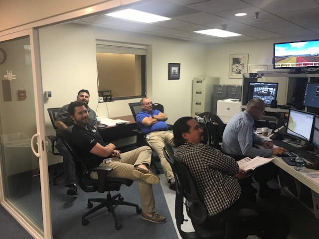
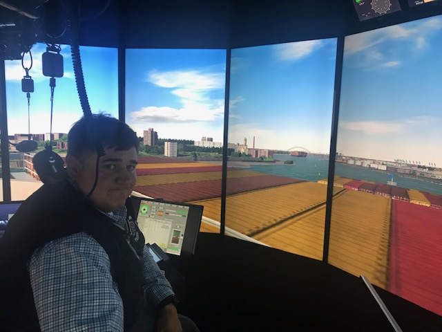
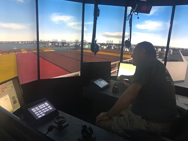
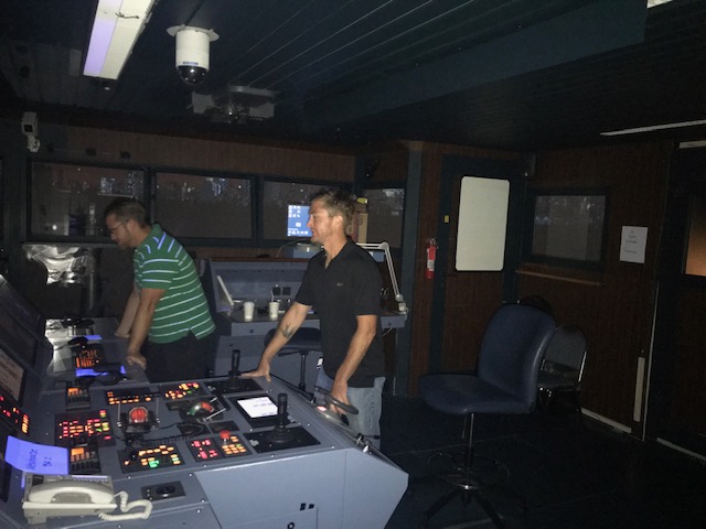
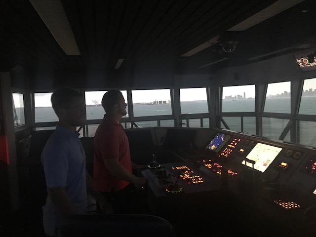
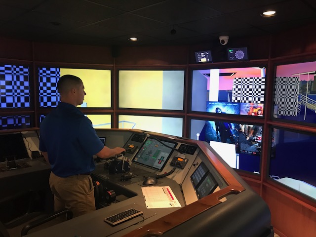
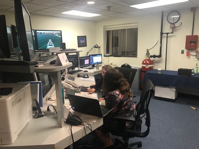
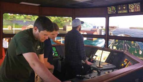
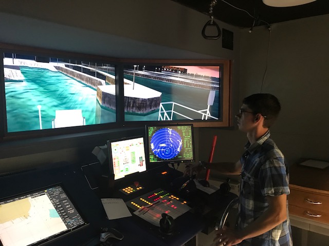
Last month, MITAGS worked with the Staten Island Ferries and the NYC Ferry to conduct simulation research to assess safety concerns from the maritime community regarding additional ferry service by NYC Ferry at the St. George terminal. The assessment included the following:
- Separate simulations incorporating two different landing spots. One directly under the Staten Island Ferry administration building at Slip 7, and the other approximately 300’ north of the SIF Fuel Facility;
- Utilized the current Staten Island Ferry rush hour schedule in the morning and in the afternoon;
- Utilized the proposed NYC Ferry rush hour schedule;
- Provided simulation of approaches and departures from Robbins Reef Light – slightly above the KV Buoy;
- Incorporated the radio chatter with the Ferry Terminal Supervisor and the Vessel Traffic System;
- Incorporated the normal harbor traffic on Conhook Range based on estimates from VTS;
- Incorporated speeds as obtained from AIS.
Using six of our simulators in tandem, MITAGS was able to replicate the proposed schedules of both ferry lines and the above requirements, providing all parties with the research needed to assist with making an informed decision and action plan. Representatives from the Staten Island Ferry, NYC Ferry, the Sandy Hook Pilot Association, Metro Pilots and the U.S. Coast Guard were present.
Related Posts
Vane Bros’ Mariners Join in Bridge Resource Mgmt Refresher
Earlier this year Vane Brothers sent several dozen of their mariners to MITAGS facilities on both coasts for our Bridge Resource Management Refresher course.

Meet Sea Sisters x MITAGS BST Scholarship Recipient Lauren McCool
As shared on seasisters.org: www.seasisters.org/news/meet-lauren-mccool A few of the people who received a free BST or AFF class from the Sea Sisters x MITAGS partnership have taken their classes! We recently spoke with one of the scholarship recipients, and here’s what she had to say: Hello Sea Sisters! This is Lauren McCool, writing to thank you again for […]
Forbes: Why We Desperately Need To Bring Back Vocational Training In Schools
Throughout most of U.S. history, American high school students were routinely taught vocational and job-ready skills along with the three Rs: reading, writing and arithmetic. Indeed readers of a certain age are likely to have fond memories of huddling over wooden workbenches learning a craft such as woodwork or maybe metal work, or any one of the hands-on projects that characterized the once-ubiquitous shop class. But in the 1950s, a different philosophy emerged...